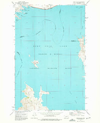
1972 Map of York Island
USGS Topo · Published 1975About this map
Fort Peck Lake dominates this landscape, its waters filling the Missouri River valley and various coulees across the Charles M Russell National Wildlife Range. This 1970s survey captures the shoreline where three counties meet — Valley, McCone, and Garfield — following the complex geometry of the impounded river. The presence of Fort Peck Dam at the northern edge is the defining engineering feature, creating a series of deep-water bays like Sturgeon Bay and Catfish Bay that transformed the original river channel. On the water, York Island stands as a prominent landmark between the main lake body and the Dry Arm. Grounded markers like the Radio Tower near the dam and various lights at Markles Point and Haxby Point provide essential navigational references for the area's recreational and wildlife management infrastructure.
Find a feature on this map
20 named features on this map. Tap any name to fly to it.
Don’t see what you’re looking for? This feature index may not catch every label — zoom into the map to look around manually.
Map Details
Editions of this 1972 York Island Map
This is the sole edition of this map. No revisions or reprints were ever made.
Other maps of this area

1914 · Nashua
USGS Topo · 1:62,500

1916 · Nashua
USGS Topo · 1:62,500

1943 · Glasgow
USGS Topo · 1:125,000

1954 · Jordan
USGS Topo · 1:250,000

1954 · Glasgow
USGS Topo · 1:250,000

1956 · Jordan
USGS Topo · 1:250,000

1957 · Glasgow
USGS Topo · 1:250,000

1958 · Glasgow
USGS Topo · 1:250,000

1958 · Jordan
USGS Topo · 1:250,000

1958 · Sage Creek Point
USGS Topo · 1:24,000