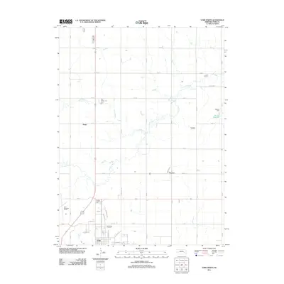
2011 Map of York North
USGS Topo · Published 2011About this map
The city of York serves as the focal point for this 2011 survey, showing the community's expansion northward through the York County Fairgrounds and surrounding residential streets like Edison Ave and Lincoln Ave. The landscape is defined by the agricultural grid typical of York County, bisected by the wandering course of Lincoln Creek and its tributary, Coon Branch. Smaller named localities such as Houston and Mapps appear along the section roads, alongside established rural landmarks like Zion Cemetery and Rosemond Cemetery. This map captures a detailed view of local infrastructure, from the York Municipal Airport on the western edge to the Wessels Dam and Wessels Reservoir to the east, illustrating the intersection of modern municipal utility and the region's deep farming roots.
Find a feature on this map
40 named features on this map. Tap any name to fly to it.
Don’t see what you’re looking for? This feature index may not catch every label — zoom into the map to look around manually.
Map Details
Editions of this 2011 York North Map
This is the sole edition of this map. No revisions or reprints were ever made.
Other maps of this area

1896 · Stromsburg
USGS Topo · 1:125,000

1898 · York
USGS Topo · 1:125,000

1899 · David City
USGS Topo · 1:125,000

1899 · York
USGS Topo · 1:125,000

1934 · Utica
USGS Topo · 1:62,500

1937 · Utica
USGS Topo · 1:62,500

1955 · Fremont
USGS Topo · 1:250,000

1955 · Lincoln
USGS Topo · 1:250,000

1957 · Fremont
USGS Topo · 1:250,000

1957 · Lincoln
USGS Topo · 1:250,000