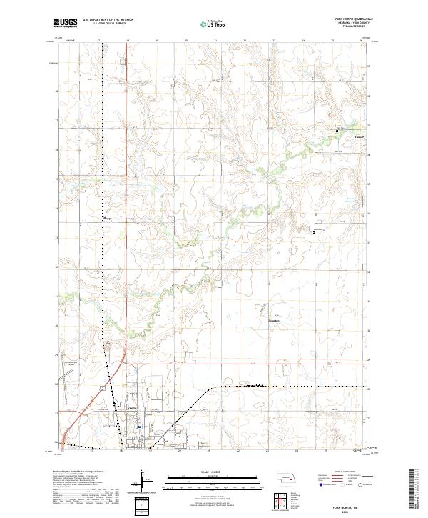
2021 Map of York North
USGS Topo · Published 2021About this map
The northern reaches of York anchor this landscape, where the city's residential streets and industrial corridors give way to the sprawling agricultural tracts of York County. The York Municipal Airport marks the southwestern corner, serving as a modern landmark in a region defined by its long-standing farming tradition. Water distribution is evident through the winding course of Lincoln Cr and Coon Br, which meander across the plains toward Wessels Reservoir.
Find a feature on this map
35 named features on this map. Tap any name to fly to it.
Don’t see what you’re looking for? This feature index may not catch every label — zoom into the map to look around manually.
Map Details
Editions of this 2021 York North Map
This is the sole edition of this map. No revisions or reprints were ever made.
Other maps of this area

1896 · Stromsburg
USGS Topo · 1:125,000

1898 · York
USGS Topo · 1:125,000

1899 · David City
USGS Topo · 1:125,000

1899 · York
USGS Topo · 1:125,000

1934 · Utica
USGS Topo · 1:62,500

1937 · Utica
USGS Topo · 1:62,500

1955 · Fremont
USGS Topo · 1:250,000

1955 · Lincoln
USGS Topo · 1:250,000

1957 · Fremont
USGS Topo · 1:250,000

1957 · Lincoln
USGS Topo · 1:250,000