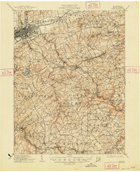
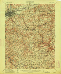
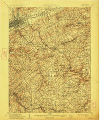
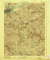
1910 Map of York
USGS Topo · Published 1948About this map
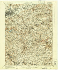
York serves as the industrial and transit anchor in the northwestern corner of this survey, where the Northern Central RR meets the winding Codorus Creek. The landscape transitions from the dense urban grid of the city to a hinterland of small agricultural and manufacturing hamlets connected by early pikes like the York and Wrightsville Pike. Local industry is evidenced by sites such as Margaretta Furnace and several scattered processing hubs like Leinhart Mill and Reynolds Mill.
Find a feature on this map
142 named features on this map. Tap any name to fly to it.
Don’t see what you’re looking for? This feature index may not catch every label — zoom into the map to look around manually.
Map Details
Editions of this 1910 York Map
6 editions found
Other maps of this area

1900 · Parkton
USGS Topo · 1:62,500

1901 · Belair
USGS Topo · 1:62,500

1902 · Parkton
USGS Topo · 1:62,500

1902 · Lancaster
USGS Topo · 1:62,500

1904 · Lancaster
USGS Topo · 1:62,500

1905 · Westminster
USGS Topo · 1:62,500

1906 · New Cumberland
USGS Topo · 1:62,500

1908 · Middletown
USGS Topo · 1:62,500

1908 · York
USGS Topo · 1:62,500

1910 · York
USGS Topo · 1:62,500