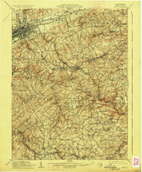
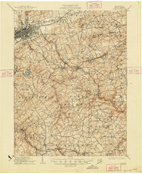
1910 Map of York
USGS Topo · Published 1927About this map
York and its surrounding boroughs are depicted during a period of robust industrial and agricultural expansion in south-central Pennsylvania. The landscape is defined by the winding course of Codorus Creek and the intricate rail network of the Northern Central RR and the Pennsylvania RR, which spurred the growth of manufacturing centers like Red Lion and Dallastown. These towns, along with smaller settlements such as Yoe and Windsor, are linked by historic thoroughfares including the Wrightsville Plank Road and the Stewartstown Turnpike.
Find a feature on this map
110 named features on this map. Tap any name to fly to it.
Don’t see what you’re looking for? This feature index may not catch every label — zoom into the map to look around manually.
Map Details
Editions of this 1910 York Map
6 editions found
Other maps of this area

1900 · Parkton
USGS Topo · 1:62,500

1901 · Belair
USGS Topo · 1:62,500

1902 · Parkton
USGS Topo · 1:62,500

1902 · Lancaster
USGS Topo · 1:62,500

1904 · Lancaster
USGS Topo · 1:62,500

1905 · Westminster
USGS Topo · 1:62,500

1906 · New Cumberland
USGS Topo · 1:62,500

1908 · Middletown
USGS Topo · 1:62,500

1908 · York
USGS Topo · 1:62,500

1910 · York
USGS Topo · 1:62,500