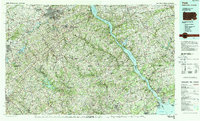
1983 Map of York
USGS Topo · Published 1988About this map
The Susquehanna River serves as the central artery for this mid-Atlantic landscape, cutting through a mosaic of rolling hills and established industrial centers. Large-scale water management projects are prominent, from the wide reach of the Conowingo Reservoir and Lake Clarke to the Prettyboy Reservoir in the south. The urban footprint of York and Hanover anchors the northwestern quadrant, while the southern edge meets the headwaters of the Chesapeake Bay near Havre de Grace.
Find a feature on this map
67 named features on this map. Tap any name to fly to it.
Don’t see what you’re looking for? This feature index may not catch every label — zoom into the map to look around manually.
Map Details
Editions of this 1983 York Map
2 editions found
Other maps of this area

1892 · Ellicott
USGS Topo · 1:62,500

1893 · Gunpowder
USGS Topo · 1:62,500

1893 · Frederick
USGS Topo · 1:125,000

1894 · Ellicott
USGS Topo · 1:62,500

1894 · Baltimore
USGS Topo · 1:62,500

1894 · Frederick
USGS Topo · 1:125,000

1898 · Elkton
USGS Topo · 1:62,500

1898 · Tolchester
USGS Topo · 1:125,000

1899 · Dover
USGS Topo · 1:125,000

1899 · Baltimore
USGS Topo · 1:62,500