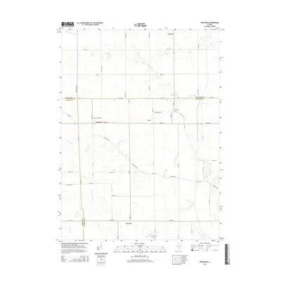
2015 Map of Yorktown
USGS Topo · Published 2015About this map
Yorktown and its neighboring rural crossroads sit at the junction of Whiteside, Bureau, and Henry Counties in this mid-2010s topographic study. The landscape is defined by an extensive drainage network, including the Fairfield Ditch Number 1, Wildcat Ditch, and the Fairfield Union Special Ditch, which manage water across this fertile agricultural region. This infrastructure highlights the long-term engineering required to maintain the productivity of the Illinois prairie.
Find a feature on this map
39 named features on this map. Tap any name to fly to it.
Don’t see what you’re looking for? This feature index may not catch every label — zoom into the map to look around manually.
Map Details
Editions of this 2015 Yorktown Map
This is the sole edition of this map. No revisions or reprints were ever made.
Other maps of this area

1921 · Buda
USGS Topo · 1:62,500

1923 · Buda
USGS Topo · 1:62,500

1929 · Annawan
USGS Topo · 1:62,500

1932 · Prophetstown
USGS Topo · 1:48,000

1932 · Annawan
USGS Topo · 1:62,500

1936 · Prophetstown
USGS Topo · 1:62,500

1949 · Walnut
USGS Topo · 1:62,500

1958 · Aurora
USGS Topo · 1:250,000

1961 · Aurora
USGS Topo · 1:250,000
1982 · New Bedford
USGS Topo · 1:24,000