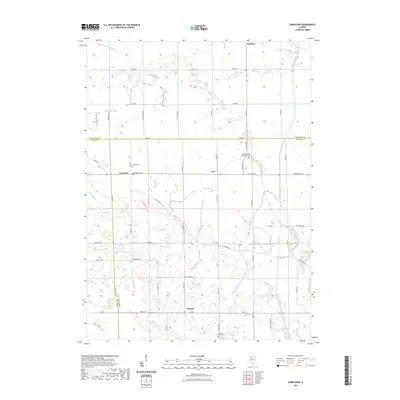
2021 Map of Yorktown
USGS Topo · Published 2021About this map
Yorktown serves as a central hub in this agricultural landscape where the borders of Whiteside, Henry, and Bureau counties meet. The region is defined by a sophisticated water management system designed for prairie drainage, featuring the Fairfield Union Special Ditch, Wildcat Ditch, and Fairfield Ditch Number 1. These waterways, alongside Hund Slough, illustrate the engineering required to maintain the productivity of the surrounding farmland.
Find a feature on this map
50 named features on this map. Tap any name to fly to it.
Don’t see what you’re looking for? This feature index may not catch every label — zoom into the map to look around manually.
Map Details
Editions of this 2021 Yorktown Map
This is the sole edition of this map. No revisions or reprints were ever made.
Other maps of this area

1921 · Buda
USGS Topo · 1:62,500

1923 · Buda
USGS Topo · 1:62,500

1929 · Annawan
USGS Topo · 1:62,500

1932 · Prophetstown
USGS Topo · 1:48,000

1932 · Annawan
USGS Topo · 1:62,500

1936 · Prophetstown
USGS Topo · 1:62,500

1949 · Walnut
USGS Topo · 1:62,500

1958 · Aurora
USGS Topo · 1:250,000

1961 · Aurora
USGS Topo · 1:250,000
1982 · New Bedford
USGS Topo · 1:24,000