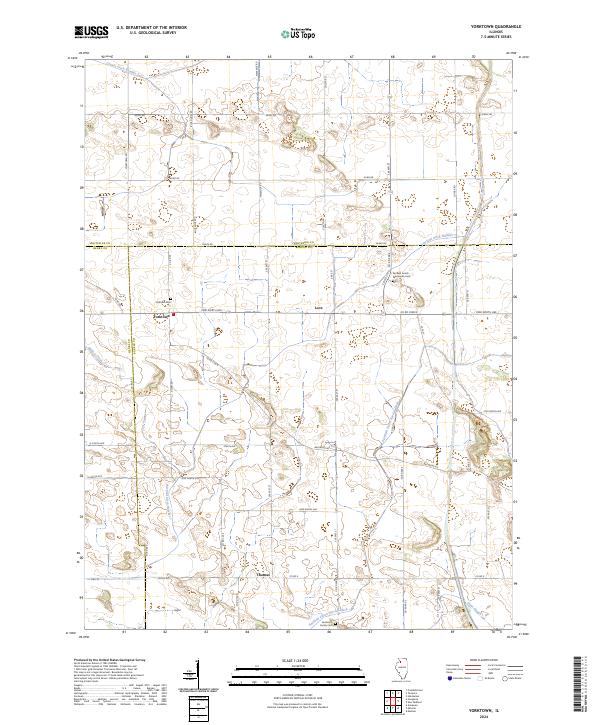
2024 Map of Yorktown
USGS Topo · Published 2024About this map
Yorktown serves as the focal point for this rural Illinois landscape, situated at the intersection of Yorktown Rd and 2900 North Ave. The area is defined by its extensive agricultural drainage network, where the Fairfield Union Special Ditch and Fairfield Ditch Number 1 cut across the prairie to manage the low-lying terrain near Hunt Slough. Small rural centers such as Love and Thomas mark the map, reflecting a pattern of settlement tied to the surrounding farmland and the grid of section roads like Backbone Rd. Local heritage is preserved in several small burial grounds, including the Yorktown Cem, the Anderson Family Cem, and the Fairfield Amish Mennonite Cem, the latter of which underscores the specific community history and religious traditions that have shaped this portion of Bureau and Whiteside counties.
Find a feature on this map
53 named features on this map. Tap any name to fly to it.
Don’t see what you’re looking for? This feature index may not catch every label — zoom into the map to look around manually.
Map Details
Editions of this 2024 Yorktown Map
This is the sole edition of this map. No revisions or reprints were ever made.
Other maps of this area

1921 · Buda
USGS Topo · 1:62,500

1923 · Buda
USGS Topo · 1:62,500

1929 · Annawan
USGS Topo · 1:62,500

1932 · Prophetstown
USGS Topo · 1:48,000

1932 · Annawan
USGS Topo · 1:62,500

1936 · Prophetstown
USGS Topo · 1:62,500

1949 · Walnut
USGS Topo · 1:62,500

1958 · Aurora
USGS Topo · 1:250,000

1961 · Aurora
USGS Topo · 1:250,000
1982 · New Bedford
USGS Topo · 1:24,000