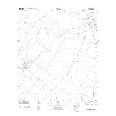
2013 Map of Yorktown West
USGS Topo · Published 2013About this map
The settlement of Nordheim stands as the primary community in this portion of DeWitt County, characterized by its distinctive diagonal grid and streets named for regional flora such as Elm St and Plum St. The surrounding landscape is a hub of Texas energy production, clearly defined by the sprawling Roeder Oil Field, Warmsley Oil Field, and Christmas Oil Field. These industrial sites are linked by a web of rural farm-to-market roads, including FM-239 and FM-952, which traverse the open ranchland.
Find a feature on this map
86 named features on this map. Tap any name to fly to it.
Don’t see what you’re looking for? This feature index may not catch every label — zoom into the map to look around manually.
Map Details
Editions of this 2013 Yorktown West Map
This is the sole edition of this map. No revisions or reprints were ever made.
Other maps of this area

1920 · Smiley
USGS Topo · 1:125,000

1953 · Beeville
USGS Topo · 1:250,000

1953 · Seguin
USGS Topo · 1:250,000

1956 · Beeville
USGS Topo · 1:250,000

1958 · Seguin
USGS Topo · 1:250,000

1960 · Beeville
USGS Topo · 1:250,000

1960 · Blackwell Lake
USGS Topo · 1:24,000

1961 · New Davy
USGS Topo · 1:24,000
1963 · Choate
USGS Topo · 1:24,000

1963 · Weesatche
USGS Topo · 1:24,000