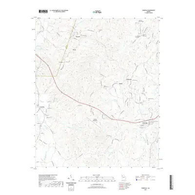
2020 Map of Yorkville
USGS Topo · Published 2020About this map
Dallas and its western outskirts sit at the heart of this Paulding County survey, where the rolling landscape is defined by the headwaters of several prominent drainage systems. The terrain transitions from the heights of Brushy Mtn down into the valleys carved by Pumpkinvine Cr and Raccoon Cr. Rural settlements like Yorkville and Braswell remain centers of local activity, connected by historic routes such as the Atlanta Hwy and the path of the Polk and Paulding County line. The map reveals a high concentration of generational burial sites, including the Old High Shoals Baptist Church Cem and Friendship Cem, which serve as vital markers for genealogical research in these long-established communities. Modern infrastructure, notably the Paulding Northwest Atlanta Airport, now shares the landscape with older landmarks like the Archibald Holland Bridge.
Find a feature on this map
113 named features on this map. Tap any name to fly to it.
Don’t see what you’re looking for? This feature index may not catch every label — zoom into the map to look around manually.
Map Details
Editions of this 2020 Yorkville Map
This is the sole edition of this map. No revisions or reprints were ever made.
Other maps of this area

1886 · Rome
USGS Topo · 1:125,000

1889 · Tallapoosa
USGS Topo · 1:125,000

1890 · Cartersville
USGS Topo · 1:125,000

1891 · Marietta
USGS Topo · 1:125,000

1891 · Cartersville
USGS Topo · 1:125,000

1892 · Tallapoosa
USGS Topo · 1:125,000

1895 · Marietta
USGS Topo · 1:125,000

1896 · Cartersville
USGS Topo · 1:125,000

1897 · Marietta
USGS Topo · 1:125,000

1897 · Tallapoosa
USGS Topo · 1:125,000