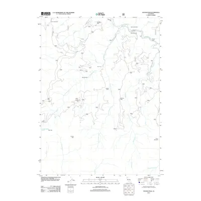
2012 Map of Youngs Peak
USGS Topo · Published 2012About this map
The S Fork Salmon River cuts through the northern reach of this mountain landscape, where the Cecilville Rd follows the water's edge. This 2012 survey illustrates the complex drainage network of the Klamath Mountains, defined by the extensive Knownothing Cr system and its east and west forks. Human presence is sparse and localized, represented by the Barton Cabin and the riverside Hotelling Campground. The terrain is marked by deep gulches such as Henry Bell Gulch and O'Farrill Gulch, while high points like Youngs Peak and Bowerman Peak overlook the narrow valleys. A small high-elevation water body, Knownothing Lake, sits tucked beneath Slate Gap, while historic river crossings like Jack Harveys Crossing and bars like Missouri Bar hint at the area's gold-mining and pioneer heritage.
Find a feature on this map
55 named features on this map. Tap any name to fly to it.
Don’t see what you’re looking for? This feature index may not catch every label — zoom into the map to look around manually.
Map Details
Editions of this 2012 Youngs Peak Map
This is the sole edition of this map. No revisions or reprints were ever made.
Other maps of this area

1948 · Weed
USGS Topo · 1:250,000

1950 · Weed
USGS Topo · 1:250,000

1955 · Salmon Mtn
USGS Topo · 1:62,500

1955 · Cecilville
USGS Topo · 1:62,500

1955 · Sawyers Bar
USGS Topo · 1:62,500

1955 · Forks of Salmon
USGS Topo · 1:62,500

1958 · Weed
USGS Topo · 1:250,000

1963 · Weed
USGS Topo · 1:250,000

1974 · Orleans Mtn.
USGS Topo · 1:24,000
1978 · Cecilville
USGS Topo · 1:24,000