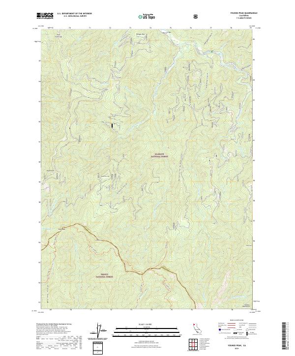
2021 Map of Youngs Peak
USGS Topo · Published 2021About this map
The Salmon River cuts through the northern reaches of this territory, where the Klamath Wild and Scenic River designation protects the riparian corridor within the Klamath National Forest. Steep drainage networks like Hotelling Gulch and Granite Gulch define the vertical landscape, leading upward to prominent summits such as Youngs Peak and Bowerman Peak. These peaks are connected by an extensive system of ridge-running paths, including the Salmon Summit Trl and Hotelling Trl.
Find a feature on this map
43 named features on this map. Tap any name to fly to it.
Don’t see what you’re looking for? This feature index may not catch every label — zoom into the map to look around manually.
Map Details
Editions of this 2021 Youngs Peak Map
This is the sole edition of this map. No revisions or reprints were ever made.
Other maps of this area

1948 · Weed
USGS Topo · 1:250,000

1950 · Weed
USGS Topo · 1:250,000

1955 · Salmon Mtn
USGS Topo · 1:62,500

1955 · Cecilville
USGS Topo · 1:62,500

1955 · Sawyers Bar
USGS Topo · 1:62,500

1955 · Forks of Salmon
USGS Topo · 1:62,500

1958 · Weed
USGS Topo · 1:250,000

1963 · Weed
USGS Topo · 1:250,000

1974 · Orleans Mtn.
USGS Topo · 1:24,000
1978 · Cecilville
USGS Topo · 1:24,000