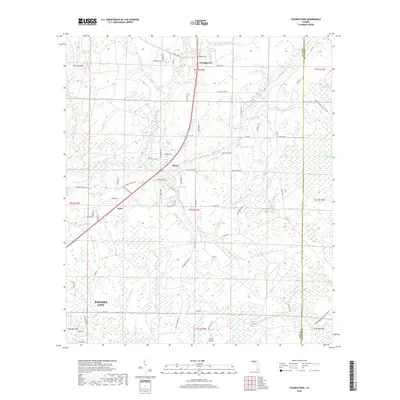
2018 Map of Youngstown
USGS Topo · Published 2018About this map
Youngstown and the surrounding pine lands of northern Bay County are defined by an intricate network of wetlands and small drainages flowing toward the coast. The settlement at Nixon sits near the headwaters of Bear Creek, while the northern portion of Panama City begins to emerge along the lower margins of the sheet. The landscape is dominated by named wetlands such as Old Camp Four Swamp, Bearthick Swamp, and Green Bay Swamp, illustrating the hydrologic character of the Florida Panhandle before heavy modern development. These drainages, including Bird Pond Slough and Bayou George, shaped the placement of early roads like Scotts Ferry Rd and Happyville Rd. The map also captures the local topography of Crash Island and the meandering course of Juniper Cr, providing a detailed look at the rural interior just north of the coastal centers.
Find a feature on this map
81 named features on this map. Tap any name to fly to it.
Don’t see what you’re looking for? This feature index may not catch every label — zoom into the map to look around manually.
Map Details
Editions of this 2018 Youngstown Map
This is the sole edition of this map. No revisions or reprints were ever made.
Other maps of this area

1944 · Bayhead
USGS Topo · 1:24,000

1944 · Bennett
USGS Topo · 1:24,000

1945 · Juniper Creek
USGS Topo · 1:31,680

1945 · Youngstown
USGS Topo · 1:31,680

1945 · Bennett
USGS Topo · 1:31,680

1945 · Bayhead
USGS Topo · 1:31,680

1945 · Broad Branch
USGS Topo · 1:31,680

1945 · North Of Allanton
USGS Topo · 1:31,680

1945 · Fountain
USGS Topo · 1:31,680

1945 · Tenmile Swamp
USGS Topo · 1:31,680