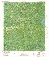
1982 Map of Youngstown
USGS Topo · Published 1983About this map
The Atlanta and Saint Andrews Bay Railway cuts a straight diagonal through this Florida landscape, anchoring the settlements of Youngstown and Nixon. The terrain is defined by a dense network of hydrologic features, from the meandering Bear Creek and Little Bear Creek to the swampy reaches of Bearthick Swamp and Green Bay Swamp. While much of the area remains undeveloped wetland and woodland, local life is marked by the Bear Creek Ch, a small Cem, and a handful of rural roads like Camp Flowers Road and Scotts Ferry Road.
Find a feature on this map
28 named features on this map. Tap any name to fly to it.
Don’t see what you’re looking for? This feature index may not catch every label — zoom into the map to look around manually.
Map Details
Editions of this 1982 Youngstown Map
This is the sole edition of this map. No revisions or reprints were ever made.
Other maps of this area

1944 · Bayhead
USGS Topo · 1:24,000

1944 · Bennett
USGS Topo · 1:24,000

1945 · Juniper Creek
USGS Topo · 1:31,680

1945 · Youngstown
USGS Topo · 1:31,680

1945 · Bennett
USGS Topo · 1:31,680

1945 · Bayhead
USGS Topo · 1:31,680

1945 · Broad Branch
USGS Topo · 1:31,680

1945 · North Of Allanton
USGS Topo · 1:31,680

1945 · Fountain
USGS Topo · 1:31,680

1945 · Tenmile Swamp
USGS Topo · 1:31,680