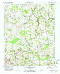
1952 Map of Youngville
USGS Topo · Published 1981About this map
The South Fork Red River carves a winding path through this northern Tennessee landscape, anchoring a rural network of small crossroads and farming communities. In the mid-20th century, the area was defined by its localized infrastructure, featuring numerous community landmarks like Brick Sch and Corinth Ch. The terrain transitions from the well-drained heights near Youngville to the low-lying wetlands known as The Swamps in the central-west. Significant water features such as Wartrace Lake and the State Fish Hatchery indicate a landscape managed for both recreation and resource conservation. Local genealogists will find value in the scattered Cem labels and several educational sites like Krisle Sch and Benton Sch, which represent the social hubs of Robertson County before the expansion of modern school districts.
Find a feature on this map
30 named features on this map. Tap any name to fly to it.
Don’t see what you’re looking for? This feature index may not catch every label — zoom into the map to look around manually.
Map Details
Editions of this 1952 Youngville Map
2 editions found
Other maps of this area

1903 · Nashville
USGS Topo · 1:125,000

1931 · Ridgetop
USGS Topo · 1:62,500

1935 · Ridgetop
USGS Topo · 1:62,500

1942 · Gallatin
USGS Topo · 1:100,000

1951 · Adairville
USGS Topo · 1:24,000

1951 · Dot
USGS Topo · 1:24,000

1951 · Prices Mill
USGS Topo · 1:24,000

1952 · Springfield North
USGS Topo · 1:24,000

1952 · Youngville
USGS Topo · 1:24,000

1953 · Orlinda
USGS Topo · 1:24,000