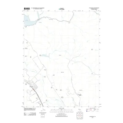
2012 Map of Yountville
USGS Topo · Published 2012About this map
The Napa River valley and its surrounding highlands define this region of California's wine country. Yountville serves as the primary hub of activity, surrounded by an extensive network of vineyards and wineries such as Domaine Chandon Winery, Silver Oak Cellars, and Stags Leap Wine Cellars. The landscape transitions from the flat valley floor to the prominent ridges of Stags Leap and Atlas Peak. Significant water management features are evident throughout the terrain, including Lake Hennessey in the north and the Rector Reservoir tucked into Rector Canyon. This topography highlights the vital relationship between the local geography and the agriculture of the region, from the valley vineyards to the isolated homesteads like the Circle S Ranch. Tracing roads like the Silverado Trl reveals the established corridor that has long connected these historic viticultural properties.
Find a feature on this map
55 named features on this map. Tap any name to fly to it.
Don’t see what you’re looking for? This feature index may not catch every label — zoom into the map to look around manually.
Map Details
Editions of this 2012 Yountville Map
This is the sole edition of this map. No revisions or reprints were ever made.
Other maps of this area

1902 · Napa
USGS Topo · 1:125,000

1921 · Mt. Vaca
USGS Topo · 1:62,500

1924 · Capay
USGS Topo · 1:62,500

1942 · Sonoma
USGS Topo · 1:62,500

1942 · Mt. Vaca
USGS Topo · 1:62,500

1942 · St. Helena
USGS Topo · 1:62,500

1943 · Capay
USGS Topo · 1:62,500

1945 · Capay
USGS Topo · 1:62,500

1945 · St. Helena
USGS Topo · 1:62,500

1947 · Santa Rosa
USGS Topo · 1:250,000