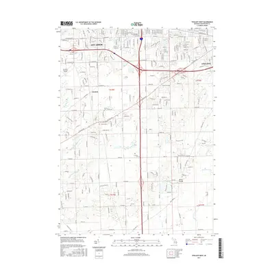
2017 Map of Ypsilanti West
USGS Topo · Published 2017About this map
Historic Terhune Graveyard and several rural burial grounds including Harwood Cem and York Cem anchor the historical geography of this corridor between Ann Arbor and Ypsilanti. The landscape transition from the academic and municipal centers of the north, including Cleary Univ and the Ann Arbor Municipal Airport, into the agricultural and township lands of Pittsfield and Stony Creek is clearly visible. Significant water management is evident through a complex network of man-made and natural waterways such as the McCarthy Drain, Koch Warner Drain, and Pittsfield Number Five Drain, which coordinate drainage through the region's low-lying areas. The southern portion of the quadrangle remains largely defined by its township grid and recreational spaces like Rolling Hills Park, contrasting with the increasingly dense residential and commercial street patterns developing along W Michigan Ave and Packard Rd.
Find a feature on this map
52 named features on this map. Tap any name to fly to it.
Don’t see what you’re looking for? This feature index may not catch every label — zoom into the map to look around manually.
Map Details
Editions of this 2017 Ypsilanti West Map
This is the sole edition of this map. No revisions or reprints were ever made.
Other maps of this area

1902 · South Lyon
USGS Topo · 1:62,500

1902 · Ypsilanti
USGS Topo · 1:62,500

1902 · Dexter
USGS Topo · 1:62,500

1904 · Ann Arbor
USGS Topo · 1:125,000

1906 · Ypsilanti
USGS Topo · 1:62,500

1906 · Dexter
USGS Topo · 1:62,500

1906 · Saline
USGS Topo · 1:62,500

1906 · South Lyon
USGS Topo · 1:62,500

1908 · Ann Arbor
USGS Topo · 1:125,000
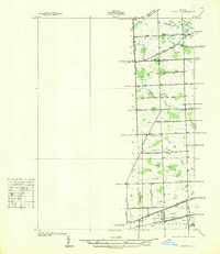
1936 · Denton
USGS Topo · 1:31,680
Featured Places
- Ann Arbor, MI
- Ypsilanti Charter Township, MI
- Pittsfield Charter Township, MI
- Ypsilanti, MI
- York Charter Township, MI