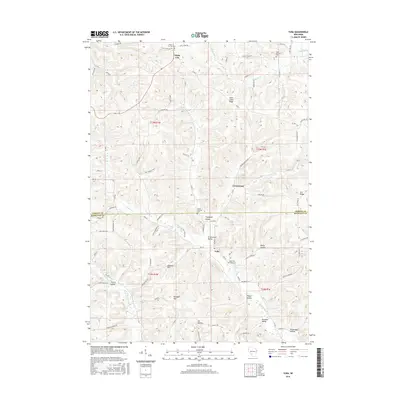
2016 Map of Yuba
USGS Topo · Published 2016About this map
Saint Johns Ridge and Fox Ridge define the upland terrain of this Driftless Area landscape, where the borders of Vernon Co and Richland Co meet. The settlement of Yuba occupies the valley floor at the confluence of Indian Cr and the Pine River, a site established long before modern surveying. This 2016 record reflects a deeply rural pattern of life, where small clusters like White City and Greenwood remain tied to the network of narrow ridges and hollows such as Rocky Hollow and Norman Valley. Genealogists will find significant value in the distribution of community burial grounds, including the Czechs National Cem and Saint Patricks Cem, which point to the diverse ethnic heritage of the families who settled these narrow valleys. The map preserves the exact alignment of historical routes like Kouba Valley Rd and Verbsky Ln, tracing how topography has dictated transportation for over a century.
Find a feature on this map
93 named features on this map. Tap any name to fly to it.
Don’t see what you’re looking for? This feature index may not catch every label — zoom into the map to look around manually.
Map Details
Editions of this 2016 Yuba Map
This is the sole edition of this map. No revisions or reprints were ever made.
Other maps of this area

1905 · Richland Center
USGS Topo · 1:125,000

1926 · La Farge
USGS Topo · 1:62,500

1927 · Hillsboro
USGS Topo · 1:62,500

1933 · Boaz
USGS Topo · 1:62,500

1958 · La Crosse
USGS Topo · 1:250,000

1960 · Richland Center
USGS Topo · 1:62,500

1961 · La Crosse
USGS Topo · 1:250,000

1965 · La Crosse
USGS Topo · 1:250,000

1965 · La Farge
USGS Topo · 1:62,500

1966 · Hillsboro
USGS Topo · 1:62,500