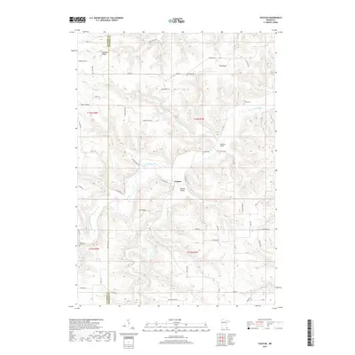
2019 Map of Yucatan
USGS Topo · Published 2019About this map
Yucatan and the winding course of the S Fork Root River define this corner of Houston County, where the Fillmore County line meets a landscape of deep valleys and prominent ridges. The settlement pattern follows the drainages, with the town center situated at the confluence of the river and Riceford Cr. This 2019 survey documents a high concentration of burial grounds, including the First Yucatan Cem, Yucatan Cem, and Old Ridge Cem, which serve as vital markers for local family historians. The terrain is distinctly characterized by named lowlands like Rooster Valley, Chisholm Valley, and Yucatan Valley, contrasting with the high ground of Irish Ridge and Oak Ridge. The road network, including Co Rd 13 and Yucatan Rd, navigates the complex topography between the river forks and their tributary creeks.
Find a feature on this map
64 named features on this map. Tap any name to fly to it.
Don’t see what you’re looking for? This feature index may not catch every label — zoom into the map to look around manually.
Map Details
Editions of this 2019 Yucatan Map
This is the sole edition of this map. No revisions or reprints were ever made.
Other maps of this area

1954 · Lewiston
USGS Topo · 1:62,500

1958 · Houston
USGS Topo · 1:62,500

1958 · La Crosse
USGS Topo · 1:250,000

1961 · La Crosse
USGS Topo · 1:250,000

1965 · La Crosse
USGS Topo · 1:250,000

1965 · Wilmington
USGS Topo · 1:24,000

1965 · Mabel
USGS Topo · 1:24,000

1965 · Spring Grove
USGS Topo · 1:24,000

1965 · Sheldon
USGS Topo · 1:24,000

1965 · Yucatan
USGS Topo · 1:24,000