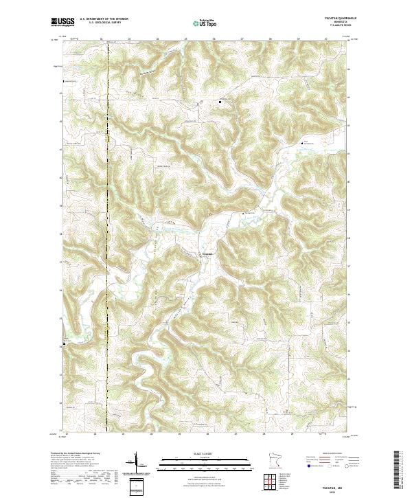
2022 Map of Yucatan
USGS Topo · Published 2022About this map
Yucatan sits at the heart of a deeply dissected landscape on the border of Fillmore and Houston counties. The area is defined by a complex system of drainage and high ground, including Yucatan Valley, Rooster Valley, and Chisholm Valley. These lowlands are separated by prominent landforms like Oak Ridge and Irish Ridge, creating a terrain where agriculture and settlement follow the winding paths of the S Fork Root River and Riceford Cr.
Find a feature on this map
55 named features on this map. Tap any name to fly to it.
Don’t see what you’re looking for? This feature index may not catch every label — zoom into the map to look around manually.
Map Details
Editions of this 2022 Yucatan Map
This is the sole edition of this map. No revisions or reprints were ever made.
Other maps of this area

1954 · Lewiston
USGS Topo · 1:62,500

1958 · Houston
USGS Topo · 1:62,500

1958 · La Crosse
USGS Topo · 1:250,000

1961 · La Crosse
USGS Topo · 1:250,000

1965 · La Crosse
USGS Topo · 1:250,000

1965 · Wilmington
USGS Topo · 1:24,000

1965 · Mabel
USGS Topo · 1:24,000

1965 · Spring Grove
USGS Topo · 1:24,000

1965 · Sheldon
USGS Topo · 1:24,000

1965 · Yucatan
USGS Topo · 1:24,000