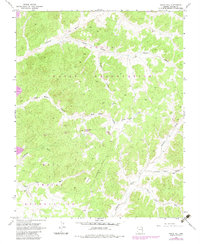
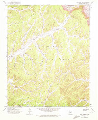
1968 Map of Yucca Hill
USGS Topo · Published 1983About this map
Navajo Indian Reservation and Hopi Indian Reservation lands dominate this high-desert landscape in northern Arizona, divided by the prominent Old Indian Reservation Boundary. The terrain is defined by a series of northwest-trending drainages, including Moenkopi Wash and Dinnebito Wash, which carve through alluvial features like Yucca Flat. Human impact on this arid environment is localized but distinct, evidenced by the Strip Mine operations in the northwest and small-scale infrastructure such as Reed Well, a Corral, and a Prospect. The complex topography of Yucca Hill and the branching corridors of Reed Valley and Dugout Valley illustrate a traditional ranching and mining landscape as it appeared in the late 1960s, prior to 1980s photogrammetric revisions.
Find a feature on this map
21 named features on this map. Tap any name to fly to it.
Don’t see what you’re looking for? This feature index may not catch every label — zoom into the map to look around manually.
Map Details
Editions of this 1968 Yucca Hill Map
2 editions found
Other maps of this area

1883 · Marsh Pass
USGS Topo · 1:250,000

1892 · Marsh Pass
USGS Topo · 1:250,000

1956 · Marble Canyon
USGS Topo · 1:250,000

1959 · Marble Canyon
USGS Topo · 1:250,000

1961 · Marble Canyon
USGS Topo · 1:250,000
1968 · Owl Valley
USGS Topo · 1:24,000
1968 · Toh Ne Zhonnie Spring
USGS Topo · 1:24,000
1968 · Owl Spring
USGS Topo · 1:24,000

1968 · Yucca Hill
USGS Topo · 1:24,000
1968 · Cliff Rose Hill
USGS Topo · 1:24,000