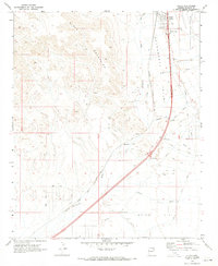
1970 Map of Yucca
USGS Topo · Published 1973About this map
The high desert of the Sacramento Valley dominates this 1970 survey, where the settlement of Yucca serves as a primary transit point. Situated between the Black Mountains to the west and the expansive Dutch Flat to the southeast, the landscape is defined by its infrastructure. Major transportation arteries like the Atchison Topeka and Santa Fe Railroad Grade and the West Yucca Interchange illustrate the area's role as a logistical corridor through Mohave County.
Find a feature on this map
36 named features on this map. Tap any name to fly to it.
Don’t see what you’re looking for? This feature index may not catch every label — zoom into the map to look around manually.
Map Details
Editions of this 1970 Yucca Map
2 editions found
Other maps of this area

1903 · Needles
USGS Topo · 1:125,000

1904 · Needles Special
USGS Topo · 1:125,000

1927 · Yucca
USGS Topo · 1:62,500

1927 · Buck Mountains
USGS Topo · 1:62,500

1929 · Buck Mountains
USGS Topo · 1:62,500

1929 · Yucca
USGS Topo · 1:62,500

1943 · Topock
USGS Topo · 1:62,500

1950 · Topock
USGS Topo · 1:62,500

1951 · Topock
USGS Topo · 1:62,500

1954 · Needles
USGS Topo · 1:250,000