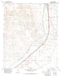
1970 Map of Yucca
USGS Topo · Published 1986About this map
Yucca serves as a primary hub where the Atchison Topeka and Santa Fe RR and modern interstate corridors converge within the Sacramento Valley. This survey, based on 1969 aerial photography, documents the infrastructure of western Arizona during a period of transition, where the historical path of the National Old Trails Road and the Old Grade meet the evolving high-speed transit network of the West Yucca Interchange and Gem Acres Interchange. To the east, the Kingman Ground Automotive Proving area occupies the desert floor, while the western horizon is dominated by the jagged peaks of the Black Mountains. Numerous Prospect sites and Drill Holes scattered across the foothills reflect the ongoing mineral exploration in the region. Smaller named locales such as Haviland and Illavar appear alongside the tracks, marking the legacy of the rail-dependent economy of the Mojave.
Find a feature on this map
35 named features on this map. Tap any name to fly to it.
Don’t see what you’re looking for? This feature index may not catch every label — zoom into the map to look around manually.
Map Details
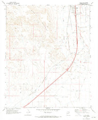
Editions of this 1970 Yucca Map
2 editions found
Other maps of this area

1903 · Needles
USGS Topo · 1:125,000

1904 · Needles Special
USGS Topo · 1:125,000

1927 · Yucca
USGS Topo · 1:62,500

1927 · Buck Mountains
USGS Topo · 1:62,500

1929 · Buck Mountains
USGS Topo · 1:62,500

1929 · Yucca
USGS Topo · 1:62,500

1943 · Topock
USGS Topo · 1:62,500

1950 · Topock
USGS Topo · 1:62,500

1951 · Topock
USGS Topo · 1:62,500

1954 · Needles
USGS Topo · 1:250,000