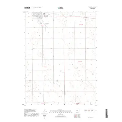
2019 Map of Yuma South
USGS Topo · Published 2019About this map
The high plains of eastern Colorado define this 2019 survey, centered on the southern reaches of Yuma. The town's grid extends southward from the northern edge of the map, organized by thoroughfares such as W 3rd Ave and W 8th Ave. A notable transition occurs from the urban residential blocks to the expansive agricultural landscape, where the Jeffersonian grid is marked by a network of county roads including Co Rd 38 and Co Rd 30. Aviation plays a central role in the local infrastructure, evidenced by both the Yuma Municipal Airport and the nearby Koenig Airport. The terrain is characterized by subtle undulations and drainage patterns typical of the region, punctuated by local water features like Lake Yuma. The map also captures the township and range boundaries for T1N, T2N, and T1S, providing a clear view of the area's land management and development patterns during the early 21st century.
Find a feature on this map
28 named features on this map. Tap any name to fly to it.
Don’t see what you’re looking for? This feature index may not catch every label — zoom into the map to look around manually.
Map Details
Editions of this 2019 Yuma South Map
This is the sole edition of this map. No revisions or reprints were ever made.
Other maps of this area

1954 · Limon
USGS Topo · 1:250,000

1954 · Sterling
USGS Topo · 1:250,000

1957 · Limon
USGS Topo · 1:250,000

1958 · Limon
USGS Topo · 1:250,000

1958 · Sterling
USGS Topo · 1:250,000

1969 · Heartstrong
USGS Topo · 1:24,000

1969 · Schramm
USGS Topo · 1:24,000

1971 · Yuma NE
USGS Topo · 1:24,000

1972 · Hyde
USGS Topo · 1:24,000

1972 · Otis SE
USGS Topo · 1:24,000