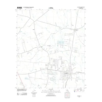
2012 Map of Zachary
USGS Topo · Published 2012About this map
Zachary and its surrounding countryside represent a shifting landscape in East Baton Rouge Parish, where suburban residential development meets long-standing agricultural and industrial footprints. The map details a web of local cemeteries that anchor the genealogy of the area, including Young Cem near Plains and McHugh Cem to the southeast. These burial grounds, alongside Stanford Cem and Johnson Cem, provide essential data points for local historians tracing family lineages in this part of Louisiana.
Find a feature on this map
149 named features on this map. Tap any name to fly to it.
Don’t see what you’re looking for? This feature index may not catch every label — zoom into the map to look around manually.
Map Details
Editions of this 2012 Zachary Map
This is the sole edition of this map. No revisions or reprints were ever made.
Other maps of this area

1906 · Bayou Sara
USGS Topo · 1:125,000

1939 · St. Francisville
USGS Topo · 1:62,500

1939 · Zachary
USGS Topo · 1:62,500

1945 · Jackson
USGS Topo · 1:31,680

1946 · Clinton
USGS Topo · 1:31,680

1953 · Comite
USGS Topo · 1:24,000

1954 · Zachary
USGS Topo · 1:24,000

1954 · Port Hudson
USGS Topo · 1:24,000
1954 · Clinton
USGS Topo · 1:24,000

1954 · Walls
USGS Topo · 1:24,000