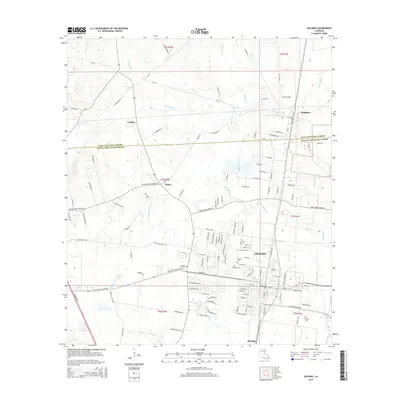
2015 Map of Zachary
USGS Topo · Published 2015About this map
Zachary serves as the central hub of this northern East Baton Rouge Parish landscape, where residential development meets the traditional drainage networks of the Louisiana lowlands. The area is defined by a dense system of waterways, including the winding Bayou Baton Rouge and White Bayou, which historically shaped the placement of early settlements and road crossings. Several small communities and named locales such as Plains, Lindsay, and Slaughter dot the periphery, illustrating the transition from rural parish lands to growing suburban centers.
Find a feature on this map
131 named features on this map. Tap any name to fly to it.
Don’t see what you’re looking for? This feature index may not catch every label — zoom into the map to look around manually.
Map Details
Editions of this 2015 Zachary Map
This is the sole edition of this map. No revisions or reprints were ever made.
Other maps of this area

1906 · Bayou Sara
USGS Topo · 1:125,000

1939 · St. Francisville
USGS Topo · 1:62,500

1939 · Zachary
USGS Topo · 1:62,500

1945 · Jackson
USGS Topo · 1:31,680

1946 · Clinton
USGS Topo · 1:31,680

1953 · Comite
USGS Topo · 1:24,000

1954 · Zachary
USGS Topo · 1:24,000

1954 · Port Hudson
USGS Topo · 1:24,000
1954 · Clinton
USGS Topo · 1:24,000

1954 · Walls
USGS Topo · 1:24,000