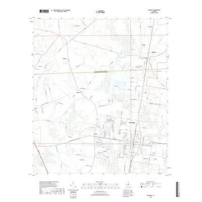
2018 Map of Zachary
USGS Topo · Published 2018About this map
Zachary serves as the primary hub of this East Baton Rouge Parish landscape, showing the town's modern residential street patterns extending toward the East Feliciana Parish line. The area is defined by a series of north-south drainage systems, including Copper Mill Bayou and White Bayou, which weave between small settlements and rural homesteads. To the north, the town of Slaughter is anchored by the Slaughter Airpark, while the western reach includes the communities of Plains and Lindsay.
Find a feature on this map
131 named features on this map. Tap any name to fly to it.
Don’t see what you’re looking for? This feature index may not catch every label — zoom into the map to look around manually.
Map Details
Editions of this 2018 Zachary Map
This is the sole edition of this map. No revisions or reprints were ever made.
Other maps of this area

1906 · Bayou Sara
USGS Topo · 1:125,000

1939 · St. Francisville
USGS Topo · 1:62,500

1939 · Zachary
USGS Topo · 1:62,500

1945 · Jackson
USGS Topo · 1:31,680

1946 · Clinton
USGS Topo · 1:31,680

1953 · Comite
USGS Topo · 1:24,000

1954 · Zachary
USGS Topo · 1:24,000

1954 · Port Hudson
USGS Topo · 1:24,000
1954 · Clinton
USGS Topo · 1:24,000

1954 · Walls
USGS Topo · 1:24,000