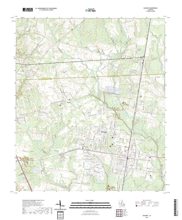
2024 Map of Zachary
USGS Topo · Published 2024About this map
Zachary stands as the primary hub of this 2024 landscape, situated at the boundary of East Feliciana and East Baton Rouge Parishes. The area is characterized by a high concentration of burial sites important to local genealogists, including the Zachary Public Cem, Young Family Cem, and the Shaw Mchugh Cem. This network of cemeteries highlights the deep-rooted family history of the surrounding settlements like Lindsay, Plains, and Slaughter.
Find a feature on this map
42 named features on this map. Tap any name to fly to it.
Don’t see what you’re looking for? This feature index may not catch every label — zoom into the map to look around manually.
Map Details
Editions of this 2024 Zachary Map
This is the sole edition of this map. No revisions or reprints were ever made.
Other maps of this area

1906 · Bayou Sara
USGS Topo · 1:125,000

1939 · St. Francisville
USGS Topo · 1:62,500

1939 · Zachary
USGS Topo · 1:62,500

1945 · Jackson
USGS Topo · 1:31,680

1946 · Clinton
USGS Topo · 1:31,680

1953 · Comite
USGS Topo · 1:24,000

1954 · Zachary
USGS Topo · 1:24,000

1954 · Port Hudson
USGS Topo · 1:24,000
1954 · Clinton
USGS Topo · 1:24,000

1954 · Walls
USGS Topo · 1:24,000