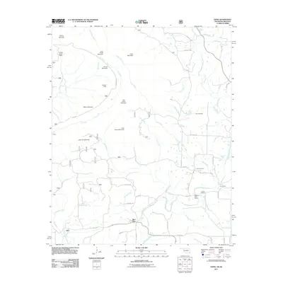
2011 Map of Zafra
USGS Topo · Published 2011About this map
West Valley and the small settlement of Zafra anchor this portrait of the Arkansas-Oklahoma borderlands in the early 21st century. The landscape is defined by the winding course of the Mountain Fork river and its many tributaries, including Choctaw Creek, Slate Creek, and Joshling Creek. Local navigation is facilitated by the Mountain Fork Bridge and a network of named timber and county roads like Polk Road 155 and Polk Road 30 that traverse the ridges. For those tracing local history, the map identifies significant family landmarks such as Stinett Cemetery and Gann Cemetery, alongside recreational sites like Camp Pioneer. The terrain is characterized by a series of distinct peaks, from Turkey Snout Ridge and Phillips Mountain in the north to Polecat Peak and Little Round Mountain near the center, illustrating the complex topography of the Ouachita region.
Find a feature on this map
75 named features on this map. Tap any name to fly to it.
Don’t see what you’re looking for? This feature index may not catch every label — zoom into the map to look around manually.
Map Details
Editions of this 2011 Zafra Map
This is the sole edition of this map. No revisions or reprints were ever made.
Other maps of this area

1890 · Poteau Mountain
USGS Topo · 1:125,000

1899 · Poteau Mountain
USGS Topo · 1:125,000

1900 · Winding Stair
USGS Topo · 1:125,000

1902 · Lukfata
USGS Topo · 1:125,000

1909 · Winding Stair
USGS Topo · 1:125,000

1913 · De Queen
USGS Topo · 1:125,000

1950 · Mcalester
USGS Topo · 1:250,000

1958 · Potter
USGS Topo · 1:62,500

1958 · Zafra
USGS Topo · 1:24,000

1958 · Rich Mountain
USGS Topo · 1:24,000