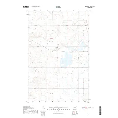
2017 Map of Zahl
USGS Topo · Published 2017About this map
Lake Zahl dominates this portion of the northwestern North Dakota landscape, providing a central hydrographic focus for the surrounding prairie of Williams County. The small settlement of Zahl sits just northwest of the lake, marked by its local Po and a grid of streets including Washburn St and 1st St E. This area is defined by its transition between upland coulees and wetland basins, where drainage features like Pats Coulee and Smoky Cr lead toward the meandering Little Muddy River. The map illustrates a strictly organized rural section-line road network, such as Co Hwy 12 and Co Rd 3, which segment the terrain into the systematic townships and ranges characteristic of the Great Plains. Water bodies like Shirley Lake further emphasize the importance of these prairie potholes to the local ecosystem and historical land use patterns.
Find a feature on this map
31 named features on this map. Tap any name to fly to it.
Don’t see what you’re looking for? This feature index may not catch every label — zoom into the map to look around manually.
Map Details
Editions of this 2017 Zahl Map
This is the sole edition of this map. No revisions or reprints were ever made.
Other maps of this area

1948 · Smoky Butte
USGS Topo · 1:24,000

1948 · Hanks
USGS Topo · 1:24,000

1948 · Stady
USGS Topo · 1:24,000

1948 · Zahl
USGS Topo · 1:24,000

1953 · Williston
USGS Topo · 1:250,000

1957 · Williston
USGS Topo · 1:250,000

1974 · Blacktail Lake
USGS Topo · 1:24,000

1974 · Bonetraill
USGS Topo · 1:24,000

1974 · Twin Lakes
USGS Topo · 1:24,000

1977 · Appam
USGS Topo · 1:24,000