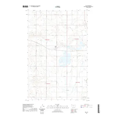
2020 Map of Zahl
USGS Topo · Published 2020About this map
The small community of Zahl sits at the heart of this northwestern North Dakota landscape, situated along a network of section roads that define the rural grid of Williams County. The terrain is characterized by a significant glacial wetland complex, where Lake Zahl and Shirley Lake provide prominent landmarks amidst the prairie. These water bodies, along with smaller features like Kettle Lake and the winding Little Muddy River, suggest a landscape shaped by glacial recession, creating numerous depressions and coulees such as Pats Coulee.
Find a feature on this map
23 named features on this map. Tap any name to fly to it.
Don’t see what you’re looking for? This feature index may not catch every label — zoom into the map to look around manually.
Map Details
Editions of this 2020 Zahl Map
This is the sole edition of this map. No revisions or reprints were ever made.
Other maps of this area

1948 · Smoky Butte
USGS Topo · 1:24,000

1948 · Hanks
USGS Topo · 1:24,000

1948 · Stady
USGS Topo · 1:24,000

1948 · Zahl
USGS Topo · 1:24,000

1953 · Williston
USGS Topo · 1:250,000

1957 · Williston
USGS Topo · 1:250,000

1974 · Blacktail Lake
USGS Topo · 1:24,000

1974 · Bonetraill
USGS Topo · 1:24,000

1974 · Twin Lakes
USGS Topo · 1:24,000

1977 · Appam
USGS Topo · 1:24,000