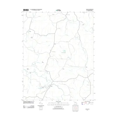
2011 Map of Zalma
USGS Topo · Published 2011About this map
The Upper Castor River flows through this Bollinger County landscape, anchoring the settlement of Zalma at a bend where the water turns east. This 2011 survey reveals a rural Missouri geography defined by family-named landmarks and the intricate drainage of Perkins Creek, Clubb Creek, and Cane Creek. The abundance of local burial grounds, including Cane Creek Cemetery, Crites Cemetery, Patterson Cemetery, and Eakers Cemetery, provides a dense record for genealogists tracing regional lineages. Small settlements like Hahn and Sank are connected by a network of county roads, while engineering on the local waterways is evident through features such as Taylor Bayless Dam and Sherman Lake Dam. Near the river, Shoal Hill rises above the terrain, overlooking the Sweetgum Public Access Area, illustrating the intersection of the natural river system and local land use in the early 21st century.
Find a feature on this map
51 named features on this map. Tap any name to fly to it.
Don’t see what you’re looking for? This feature index may not catch every label — zoom into the map to look around manually.
Map Details
Editions of this 2011 Zalma Map
This is the sole edition of this map. No revisions or reprints were ever made.
Other maps of this area

1933 · Marble Hill
USGS Topo · 1:62,500

1933 · Marquand
USGS Topo · 1:62,500

1934 · Advance
USGS Topo · 1:62,500

1935 · Zalma
USGS Topo · 1:62,500

1937 · Marble Hill
USGS Topo · 1:62,500

1938 · Marquand
USGS Topo · 1:62,500

1939 · Advance
USGS Topo · 1:62,500

1939 · Zalma
USGS Topo · 1:62,500

1949 · Paducah
USGS Topo · 1:250,000

1949 · Rolla
USGS Topo · 1:250,000