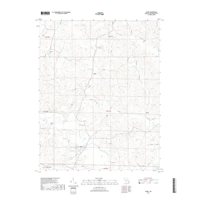
2017 Map of Zalma
USGS Topo · Published 2017About this map
The Upper Castor River meanders through this portion of Bollinger County, anchoring the settlement of Zalma. This 2017 survey reflects the enduring rural character of the region, where family and community history is preserved in numerous small burial grounds such as Cane Creek Cem, Crites Cem, and Speer Cem. The landscape is defined by its waterways, including the Virgin Cr Lake and the low-lying Dark Cypress Swamp in the southeast corner. Small crossroads like Hahn and Sank are connected by a network of county roads, while Shoal Hill provides a distinct topographic landmark. The map also notes a Field Visit 1979, indicating the continuity of geographic record-keeping in this Missouri river valley.
Find a feature on this map
66 named features on this map. Tap any name to fly to it.
Don’t see what you’re looking for? This feature index may not catch every label — zoom into the map to look around manually.
Map Details
Editions of this 2017 Zalma Map
This is the sole edition of this map. No revisions or reprints were ever made.
Other maps of this area

1933 · Marble Hill
USGS Topo · 1:62,500

1933 · Marquand
USGS Topo · 1:62,500

1934 · Advance
USGS Topo · 1:62,500

1935 · Zalma
USGS Topo · 1:62,500

1937 · Marble Hill
USGS Topo · 1:62,500

1938 · Marquand
USGS Topo · 1:62,500

1939 · Advance
USGS Topo · 1:62,500

1939 · Zalma
USGS Topo · 1:62,500

1949 · Paducah
USGS Topo · 1:250,000

1949 · Rolla
USGS Topo · 1:250,000