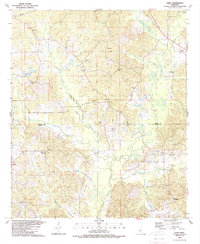
1989 Map of Zama
USGS Topo · Published 1989About this map
Lobutcha Creek and its many tributaries, including Canna Creek and Pailey Creek, define the landscape of this rural Mississippi region along the Attala and Leake County line. The settlement of Zama anchors the northeastern corner, surrounded by a network of family-centered landmarks and community sites. Small country churches such as New Salem Ch, Mt Cana Ch, and Smyrna Ch are scattered throughout the hills, often accompanied by local burial grounds like Peeler Cem and Antioch Cem. In the southern reaches, the landscape transitions toward Marydell and Crossroad, where Bibalucia Creek and Harper Branch feed into the broader drainage system. The prevalence of named points like Rocky Point and the presence of a Gravel Pit near Crossroad reflect the local economy and geography of the late twentieth century.
Find a feature on this map
38 named features on this map. Tap any name to fly to it.
Don’t see what you’re looking for? This feature index may not catch every label — zoom into the map to look around manually.
Map Details
Editions of this 1989 Zama Map
This is the sole edition of this map. No revisions or reprints were ever made.
Other maps of this area

1953 · Meridian
USGS Topo · 1:250,000

1953 · West Point
USGS Topo · 1:250,000

1957 · Meridian
USGS Topo · 1:250,000

1958 · West Point
USGS Topo · 1:250,000

1962 · Edinburg
USGS Topo · 1:62,500

1962 · Thomastown
USGS Topo · 1:62,500

1963 · West Point
USGS Topo · 1:250,000

1964 · Kosciusko
USGS Topo · 1:24,000

1965 · Meridian
USGS Topo · 1:250,000

1966 · Kosciusko
USGS Topo · 1:62,500