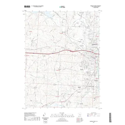
2019 Map of Zanesville West
USGS Topo · Published 2019About this map
Zanesville sits at the significant confluence of the Licking River and Muskingum River, a geographic anchor point for Muskingum County. This survey shows the urban heart of the city, including the Muskingum County Courthouse and the nearby Law Administration Building. The landscape transitions from the dense street grids of Putnam Hill and South Zanesville to the higher elevations of Nob Hill and the recreational waters of Dillon Lake in the northwest. Higher education is a prominent feature of the western city limits, with the campuses of Zane State College and Ohio University Zanesville situated near Licking View. For family historians, the map identifies numerous burial grounds such as Woodlawn Cem, Moxahala Cem, and the more rural Finley Cem and Crooks Cem. The southern reach of the map follows the winding Moxahala Creek toward the community of Darlington.
Find a feature on this map
254 named features on this map. Tap any name to fly to it.
Don’t see what you’re looking for? This feature index may not catch every label — zoom into the map to look around manually.
Map Details
Editions of this 2019 Zanesville West Map
This is the sole edition of this map. No revisions or reprints were ever made.
Other maps of this area

1908 · Conesville
USGS Topo · 1:62,500

1910 · Frazeysburg
USGS Topo · 1:62,500

1910 · Philo
USGS Topo · 1:62,500

1910 · Zanesville
USGS Topo · 1:62,500

1910 · Conesville
USGS Topo · 1:62,500

1947 · Columbus
USGS Topo · 1:250,000

1949 · Clarksburg
USGS Topo · 1:250,000

1950 · Marion
USGS Topo · 1:250,000

1951 · Canton
USGS Topo · 1:250,000

1953 · Canton
USGS Topo · 1:250,000