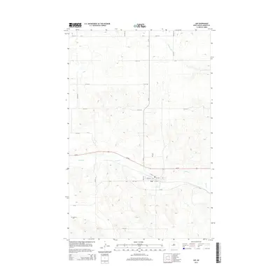
2014 Map of Zap
USGS Topo · Published 2014About this map
The settlement of Zap sits along the southern edge of the Spring Cr valley, serving as a central hub for this portion of Mercer County. The landscape is defined by the winding paths of Spring Cr and the W Br Antelope Cr to the north, which cut through the undulating plains typical of this region. Local transportation is anchored by ND-200, which runs east-west through the heart of the territory, connecting the township to the broader regional road network. For those researching family history in the area, the map identifies two significant burial sites: the Zap Cem located just north of the town center, and the more isolated Engbrecht Cem to the southwest. The grid of county roads, including CR-13 and CR-26, provides a clear view of the rural land divisions and property access points established by the early 21st century.
Find a feature on this map
26 named features on this map. Tap any name to fly to it.
Don’t see what you’re looking for? This feature index may not catch every label — zoom into the map to look around manually.
Map Details
Editions of this 2014 Zap Map
This is the sole edition of this map. No revisions or reprints were ever made.
Other maps of this area

1953 · Watford City
USGS Topo · 1:250,000

1954 · McClusky
USGS Topo · 1:250,000

1957 · Watford City
USGS Topo · 1:250,000

1958 · McClusky
USGS Topo · 1:250,000

1967 · Watford City
USGS Topo · 1:250,000

1968 · Beulah
USGS Topo · 1:24,000

1968 · Medicine Butte NE
USGS Topo · 1:24,000

1968 · Medicine Butte
USGS Topo · 1:24,000

1969 · Beulah NE
USGS Topo · 1:24,000
1969 · Beulah NW
USGS Topo · 1:24,000