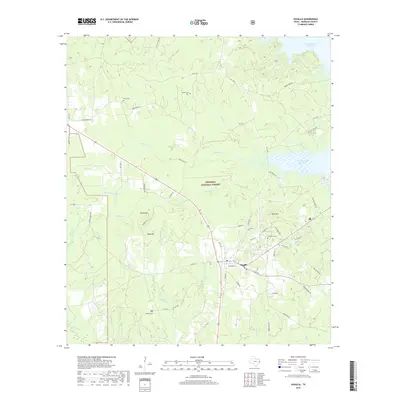
2019 Map of Zavalla
USGS Topo · Published 2019About this map
Zavalla serves as the focal point of this Angelina County landscape, situated at the junction of several regional routes that bridge the dense woodlands of the Angelina National Forest. The northeastern portion of the sheet is defined by the expansive Sam Rayburn Reservoir, where the water meets heavily timbered terrain and several named creeks including Hanks Cr and Pophers Cr. The distribution of family-named burial grounds, such as McNeil Cem, Ozias Cem, and Poland Cem, provides significant value for genealogical research, indicating the long-standing settlement patterns of this rural Texas community. Terrain features like Rocky Hill and Bald Hill offer landmarks among the drainages of Hawkins Cr and Sandy Cr, while localized water features such as Blue Spring and Ray Lake dot the landscape south of the town center. The network of county roads and forest service routes highlights the intersection of private landholdings and managed timberlands.
Find a feature on this map
63 named features on this map. Tap any name to fly to it.
Don’t see what you’re looking for? This feature index may not catch every label — zoom into the map to look around manually.
Map Details
Editions of this 2019 Zavalla Map
This is the sole edition of this map. No revisions or reprints were ever made.
Other maps of this area

1928 · Zavalla 3-c
USGS Topo · 1:24,000

1928 · Lufkin 4-d
USGS Topo · 1:24,000

1931 · Zavalla
USGS Topo · 1:62,500

1932 · Manning
USGS Topo · 1:62,500

1949 · Lufkin
USGS Topo · 1:62,500

1949 · Huntington
USGS Topo · 1:24,000

1950 · Huntington
USGS Topo · 1:24,000

1953 · Palestine
USGS Topo · 1:250,000

1957 · Palestine
USGS Topo · 1:250,000

1958 · Zavalla
USGS Topo · 1:62,500