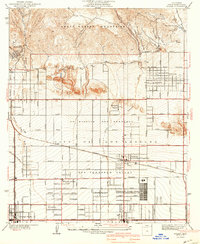
1941 Map of Zelzah
USGS Topo · Published 1941About this map
The San Fernando Valley landscape is captured here just before the massive post-war suburban transformation, showing a hybrid of agricultural colonies and burgeoning town centers. The Runnymede Poultry Colony and various large holdings like Marwyck Ranch and Glenmore Ranch illustrate the region's mid-century reliance on ranching and specialized farming. This era is marked by the dual identity of local centers, notably Zelzah Northridge PO and Sta, reflecting the transition from the older Zelzah name to the rising Northridge identity.
Find a feature on this map
42 named features on this map. Tap any name to fly to it.
Don’t see what you’re looking for? This feature index may not catch every label — zoom into the map to look around manually.
Map Details
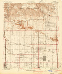
Editions of this 1941 Zelzah Map
2 editions found
Other maps of this area

1894 · Los Angeles
USGS Topo · 1:62,500

1896 · Santa Monica
USGS Topo · 1:62,500

1898 · Santa Monica
USGS Topo · 1:62,500

1900 · Los Angeles
USGS Topo · 1:62,500

1900 · Fernando
USGS Topo · 1:62,500

1901 · Southern California Sheet No. 1
USGS Topo · 1:250,000

1902 · Santa Monica
USGS Topo · 1:62,500

1903 · Calabasas
USGS Topo · 1:62,500

1903 · Camulos
USGS Topo · 1:125,000

1903 · Santa Susana
USGS Topo · 1:62,500
Featured Places
- Los Angeles, CA
- Deer Lake Highlands, Unincorporated Chatsworth
- Unincorporated Chatsworth, CA
- Los Angeles County, CA
- United States