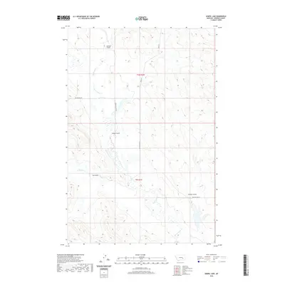
2020 Map of Zempel Lake
USGS Topo · Published 2020About this map
Big Porcupine Cr winds through the heart of this Rosebud County landscape, joined by its northern and southern tributaries, E Blacktail Cr and W Blacktail Cr. This 2020 survey illustrates a sparsely settled region of Montana defined by a complex network of coulees, which serve as natural drainages for the upland terrain. These features, including Badland Coulee, Nelson Coulee, Sun Coulee, and McGraw Coulee, underscore the geological character of the drainage basin.
Find a feature on this map
12 named features on this map. Tap any name to fly to it.
Don’t see what you’re looking for? This feature index may not catch every label — zoom into the map to look around manually.
Map Details
Editions of this 2020 Zempel Lake Map
This is the sole edition of this map. No revisions or reprints were ever made.
Other maps of this area

1954 · Forsyth
USGS Topo · 1:250,000

1957 · Forsyth
USGS Topo · 1:250,000

1958 · Forsyth
USGS Topo · 1:250,000

1960 · Hagen Ranch
USGS Topo · 1:24,000

1960 · Vananda
USGS Topo · 1:24,000

1960 · Ahles
USGS Topo · 1:24,000

1960 · Thebes
USGS Topo · 1:24,000

1960 · Brown Coulee
USGS Topo · 1:24,000

1960 · Zempel Lake
USGS Topo · 1:24,000

1968 · Donleys Reservoir
USGS Topo · 1:24,000