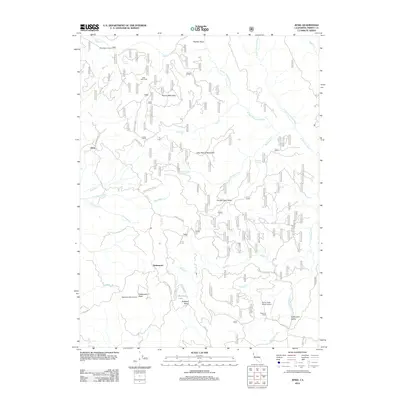
2012 Map of Zenia
USGS Topo · Published 2012About this map
Kettenpom Valley serves as a central geographic anchor for this Trinity County landscape, where the headwaters of the N Fork Eel River and its various branches carve through the high terrain. The map documents a network of Forest Service routes and remote settlements, including the namesake community of Zenia and the localized hub at Kettenpom. Human activity is concentrated along transit corridors like Ruth Zenia Rd and Covelo Rd, connecting ranching outposts such as Shannon Ranch to more isolated sites like the Kettenpom Peak Lookout. Notable landmarks such as Robbers Roost and the curiously named Hell'er High Water Airport offer specific points of interest for local historians and researchers. The drainage patterns of Bradburn Cr and Bluff Cr illustrate the complex hydrography that has shaped the area's development and land use over decades.
Find a feature on this map
43 named features on this map. Tap any name to fly to it.
Don’t see what you’re looking for? This feature index may not catch every label — zoom into the map to look around manually.
Map Details
Editions of this 2012 Zenia Map
This is the sole edition of this map. No revisions or reprints were ever made.
Other maps of this area

1918 · Anada
USGS Topo · 1:62,500

1920 · Harris
USGS Topo · 1:62,500

1921 · Hoaglin
USGS Topo · 1:62,500

1922 · Island Mountain
USGS Topo · 1:62,500

1931 · Hoaglin
USGS Topo · 1:96,000

1935 · Hoaglin
USGS Topo · 1:125,000

1949 · Blocksburg
USGS Topo · 1:62,500

1949 · Alderpoint
USGS Topo · 1:62,500

1951 · Alderpoint
USGS Topo · 1:62,500

1951 · Blocksburg
USGS Topo · 1:62,500