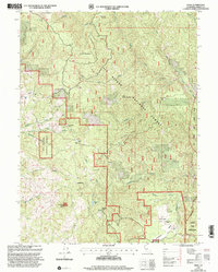
1997 Map of Zenia
USGS Topo · Published 2001About this map
Six Rivers National Forest dominates this landscape in Trinity County, where mountainous terrain meets the headwaters of several critical drainages. The small community of Zenia and the broader Kettenpom Valley serve as the primary human anchors, connected by a network of forest roads and light-duty routes. Educational and civic life is centered at the Hoaglin-Zenia School, while the presence of the Atkinson Historical Site and the former Clover School (Site) provides a window into the area's earlier rural development.
Find a feature on this map
36 named features on this map. Tap any name to fly to it.
Don’t see what you’re looking for? This feature index may not catch every label — zoom into the map to look around manually.
Map Details
Editions of this 1997 Zenia Map
This is the sole edition of this map. No revisions or reprints were ever made.
Other maps of this area

1918 · Anada
USGS Topo · 1:62,500

1920 · Harris
USGS Topo · 1:62,500

1921 · Hoaglin
USGS Topo · 1:62,500

1922 · Island Mountain
USGS Topo · 1:62,500

1931 · Hoaglin
USGS Topo · 1:96,000

1935 · Hoaglin
USGS Topo · 1:125,000

1949 · Blocksburg
USGS Topo · 1:62,500

1949 · Alderpoint
USGS Topo · 1:62,500

1951 · Alderpoint
USGS Topo · 1:62,500

1951 · Blocksburg
USGS Topo · 1:62,500