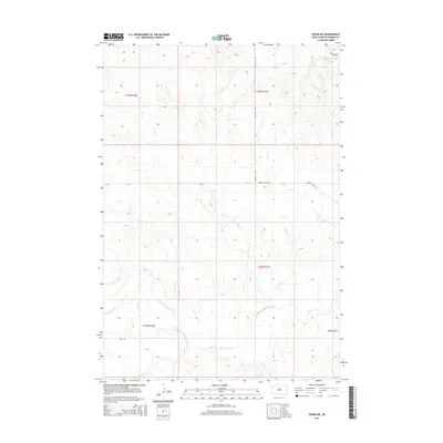
2015 Map of Zeona NE
USGS Topo · Published 2015About this map
The confluence of the South Fork Moreau River and the N Fork Moreau River creates a prominent drainage pattern in this section of Perkins County. Formed where these two primary forks meet, the main stem of the Moreau River winds eastward through a landscape defined by seasonal watercourses like Ash Cr and Mud Cr. The terrain is characterized by large-scale public land subdivisions across T15N and T14N, where isolated tracks such as Ridgeview Rd and Prairie City Rd provide the primary access to this ranching country. The presence of Dillon Draw and other erosion features underscores the semi-arid character of the region, where water management and cattle movement are historically central to land use. This 2015 survey captures the rural infrastructure of the area, including the intersection of CR-10 and Moreau River Rd.
Find a feature on this map
15 named features on this map. Tap any name to fly to it.
Don’t see what you’re looking for? This feature index may not catch every label — zoom into the map to look around manually.
Map Details
Editions of this 2015 Zeona NE Map
This is the sole edition of this map. No revisions or reprints were ever made.
Other maps of this area

1951 · Cedar Canyon
USGS Topo · 1:24,000

1951 · Imogene
USGS Topo · 1:24,000

1954 · Lemmon
USGS Topo · 1:250,000

1957 · Lemmon
USGS Topo · 1:250,000

1980 · Beverly Creek
USGS Topo · 1:25,000

1980 · Zeona
USGS Topo · 1:25,000

1983 · Date
USGS Topo · 1:24,000

1983 · Sorum SE
USGS Topo · 1:24,000
1983 · Sorum SW
USGS Topo · 1:24,000
1984 · Faith
USGS Topo · 1:100,000