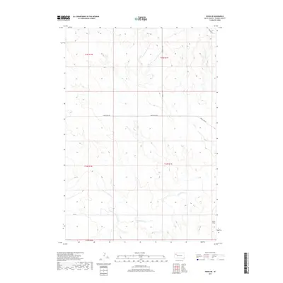
2017 Map of Zeona NE
USGS Topo · Published 2017About this map
The Moreau River system defines this corner of Perkins County, where the N Fork Moreau River and South Fork Moreau River converge to form the main channel. This drainage basin is further carved by seasonal watercourses like Ash Cr, Mud Cr, and the natural depression of Dillon Draw. The landscape is a sprawling network of ranchlands and open range, structured by the Public Land Survey System into townships such as t15n r11e and t14n r10e. Modern accessibility to these remote reaches is maintained via gravel and section-line routes, most notably Prairie City Rd and Moreau River Rd. The map illustrates the fundamental relationship between the region's topography and the sparse road network that follows the river valleys and high ridges of the Dakota plains.
Find a feature on this map
15 named features on this map. Tap any name to fly to it.
Don’t see what you’re looking for? This feature index may not catch every label — zoom into the map to look around manually.
Map Details
Editions of this 2017 Zeona NE Map
This is the sole edition of this map. No revisions or reprints were ever made.
Other maps of this area

1951 · Cedar Canyon
USGS Topo · 1:24,000

1951 · Imogene
USGS Topo · 1:24,000

1954 · Lemmon
USGS Topo · 1:250,000

1957 · Lemmon
USGS Topo · 1:250,000

1980 · Beverly Creek
USGS Topo · 1:25,000

1980 · Zeona
USGS Topo · 1:25,000

1983 · Date
USGS Topo · 1:24,000

1983 · Sorum SE
USGS Topo · 1:24,000
1983 · Sorum SW
USGS Topo · 1:24,000
1984 · Faith
USGS Topo · 1:100,000