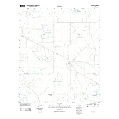
2010 Map of Zephyr
USGS Topo · Published 2010About this map
Zephyr serves as the central hub of this Central Texas landscape, situated along the crossroads of Highway 183 and FM 218. The map reveals an intricate water management system designed for the local ranching economy, characterized by numerous watershed structures like the Brownwood Lateral Watershed Number 22 and several Soil Conservation Service reservoirs. These man-made features are interwoven with natural drainages such as Blanket Creek and Pecan Creek, illustrating a long-term commitment to soil and water preservation in this rural environment.
Find a feature on this map
56 named features on this map. Tap any name to fly to it.
Don’t see what you’re looking for? This feature index may not catch every label — zoom into the map to look around manually.
Map Details
Editions of this 2010 Zephyr Map
This is the sole edition of this map. No revisions or reprints were ever made.
Other maps of this area

1889 · Brownwood
USGS Topo · 1:125,000

1894 · Brownwood
USGS Topo · 1:125,000

1925 · Brownwood 3-b
USGS Topo · 1:48,000

1925 · Brownwood 3-d
USGS Topo · 1:48,000

1925 · Brownwood 4-c
USGS Topo · 1:48,000

1928 · Zephyr
USGS Topo · 1:62,500

1931 · Mullin
USGS Topo · 1:62,500

1950 · Zephyr
USGS Topo · 1:62,500

1950 · Mullin
USGS Topo · 1:62,500

1954 · Brownwood
USGS Topo · 1:250,000