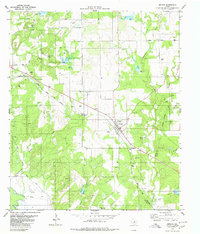
1979 Map of Zephyr
USGS Topo · Published 1980About this map
Zephyr serves as the focal point for this late-1970s survey, situated along the Atchison Topeka and Santa Fe railroad line. The settlement's local infrastructure is well-documented, featuring a Water Tank, Rodeo Ground, and the Zephyr Cemetery. To the north, Lancaster Hill rises above the town, while the surrounding landscape is marked by numerous water sources, including Jenkins Spring and Blanket Creek Spring.
Find a feature on this map
29 named features on this map. Tap any name to fly to it.
Don’t see what you’re looking for? This feature index may not catch every label — zoom into the map to look around manually.
Map Details
Editions of this 1979 Zephyr Map
This is the sole edition of this map. No revisions or reprints were ever made.
Other maps of this area

1889 · Brownwood
USGS Topo · 1:125,000

1894 · Brownwood
USGS Topo · 1:125,000

1925 · Brownwood 3-b
USGS Topo · 1:48,000

1925 · Brownwood 3-d
USGS Topo · 1:48,000

1925 · Brownwood 4-c
USGS Topo · 1:48,000

1928 · Zephyr
USGS Topo · 1:62,500

1931 · Mullin
USGS Topo · 1:62,500

1950 · Zephyr
USGS Topo · 1:62,500

1950 · Mullin
USGS Topo · 1:62,500

1954 · Brownwood
USGS Topo · 1:250,000