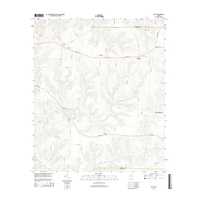
2014 Map of Zetto
USGS Topo · Published 2014About this map
The small community of Zetto sits at the intersection of local routes in this agricultural landscape near the Randolph and Clay county lines. Settled along the Edison Hwy, the area is defined by its family and church cemeteries, including Mt Vernon Cem and Wesley Cem, which provide significant points for genealogical research. The topography is shaped by the drainage of Flat Cr and the N Prong Kolomoki Cr, with various impoundments such as Fendley Lake and Mckenie Lake dotting the terrain.
Find a feature on this map
54 named features on this map. Tap any name to fly to it.
Don’t see what you’re looking for? This feature index may not catch every label — zoom into the map to look around manually.
Map Details
Editions of this 2014 Zetto Map
This is the sole edition of this map. No revisions or reprints were ever made.
Other maps of this area

1953 · Dothan
USGS Topo · 1:250,000

1954 · Dothan
USGS Topo · 1:250,000

1955 · Dothan
USGS Topo · 1:250,000

1969 · Fort Gaines
USGS Topo · 1:24,000

1969 · Fort Gaines NE
USGS Topo · 1:24,000

1970 · Columbia NE
USGS Topo · 1:24,000
1973 · Coleman
USGS Topo · 1:24,000

1973 · Blakely North
USGS Topo · 1:24,000

1973 · Bancroft
USGS Topo · 1:24,000
1973 · Carnegie
USGS Topo · 1:24,000