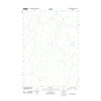
2012 Map of Zimmerman Buttes
USGS Topo · Published 2012About this map
Zimmerman Buttes rise above a landscape defined by an essential reliance on water management in this high-plains region of Washakie County. The map documents a network of strategic catchments including William Reservoir, Election Reservoir, and Pixley Reservoir, which support life and livestock where the drainage of Nowater Cr suggests a seasonally dry environment. Named terrain features like Potter Butte and Rocky Point provide navigational landmarks in a territory marked by winding coulees such as Zimmerman Draw and Little Sand Draw. The presence of Zimmerman Springs highlights the rare natural water sources that likely dictated early land use and travel routes. Infrastructure is limited to a few arterial tracks like Neiber Rd and Potter Rd, reflecting the expansive, low-density character of this Wyoming rangeland.
Find a feature on this map
13 named features on this map. Tap any name to fly to it.
Don’t see what you’re looking for? This feature index may not catch every label — zoom into the map to look around manually.
Map Details
Editions of this 2012 Zimmerman Buttes Map
This is the sole edition of this map. No revisions or reprints were ever made.
Other maps of this area

1945 · Kirby
USGS Topo · 1:62,500

1946 · Kirby
USGS Topo · 1:62,500

1955 · Thermopolis
USGS Topo · 1:250,000

1955 · Arminto
USGS Topo · 1:250,000

1958 · Thermopolis
USGS Topo · 1:250,000

1958 · Arminto
USGS Topo · 1:250,000

1960 · Coyote Hill
USGS Topo · 1:24,000

1960 · Packsaddle Creek
USGS Topo · 1:24,000

1960 · Red Hole
USGS Topo · 1:24,000

1962 · Thermopolis
USGS Topo · 1:250,000