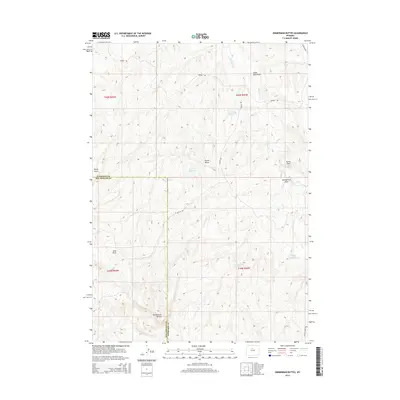
2015 Map of Zimmerman Buttes
USGS Topo · Published 2015About this map
Zimmerman Buttes anchor the southern landscape of this high plains territory where the border of Washakie and Hot Springs counties meets. This arid terrain is defined by a series of named drainages and small-scale water management features, reflecting the critical importance of water rights in this part of Wyoming. Local landforms like Potter Butte and Rocky Point provide orientation across a network of unpaved tracks, including Neiber RD and Potter RD. The distribution of water resources such as Election Reservoir, William Reservoir, and Pixley Reservoir alongside natural features like Zimmerman Springs suggests a landscape utilized for ranching and livestock. These features, coupled with various draws like Pistol Draw and the seasonally active Nowater Cr, reveal the topographic challenges and resource-focused development of the Big Horn Basin region.
Find a feature on this map
21 named features on this map. Tap any name to fly to it.
Don’t see what you’re looking for? This feature index may not catch every label — zoom into the map to look around manually.
Map Details
Editions of this 2015 Zimmerman Buttes Map
This is the sole edition of this map. No revisions or reprints were ever made.
Other maps of this area

1945 · Kirby
USGS Topo · 1:62,500

1946 · Kirby
USGS Topo · 1:62,500

1955 · Thermopolis
USGS Topo · 1:250,000

1955 · Arminto
USGS Topo · 1:250,000

1958 · Thermopolis
USGS Topo · 1:250,000

1958 · Arminto
USGS Topo · 1:250,000

1960 · Coyote Hill
USGS Topo · 1:24,000

1960 · Packsaddle Creek
USGS Topo · 1:24,000

1960 · Red Hole
USGS Topo · 1:24,000

1962 · Thermopolis
USGS Topo · 1:250,000