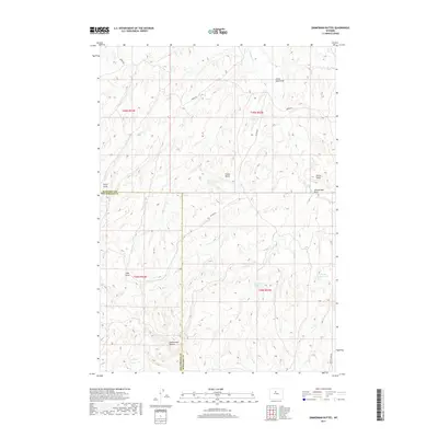
2017 Map of Zimmerman Buttes
USGS Topo · Published 2017About this map
Zimmerman Buttes rise above a landscape defined by an intricate network of drainages and intermittent water sources along the border of Washakie and Hot Springs counties. This terrain is marked by essential water management features such as William Reservoir, Election Reservoir, and Pixley Reservoir, which support life in this arid region. The land is etched by numerous draws, including Pistol Draw, Sand Draw, and Zimmerman Draw, illustrating a complex topography where seasonal runoff has carved deep paths through the soil. Grounded by early 21st-century infrastructure, the area is navigated via remote routes like Neiber Rd and Potter Rd. The presence of Zimmerman Springs and the flow of Nowater Cr suggest a landscape where water is the primary architect of movement and utility, connecting scattered landmarks like Rocky Point and Potter Butte.
Find a feature on this map
21 named features on this map. Tap any name to fly to it.
Don’t see what you’re looking for? This feature index may not catch every label — zoom into the map to look around manually.
Map Details
Editions of this 2017 Zimmerman Buttes Map
This is the sole edition of this map. No revisions or reprints were ever made.
Other maps of this area

1945 · Kirby
USGS Topo · 1:62,500

1946 · Kirby
USGS Topo · 1:62,500

1955 · Thermopolis
USGS Topo · 1:250,000

1955 · Arminto
USGS Topo · 1:250,000

1958 · Thermopolis
USGS Topo · 1:250,000

1958 · Arminto
USGS Topo · 1:250,000

1960 · Coyote Hill
USGS Topo · 1:24,000

1960 · Packsaddle Creek
USGS Topo · 1:24,000

1960 · Red Hole
USGS Topo · 1:24,000

1962 · Thermopolis
USGS Topo · 1:250,000